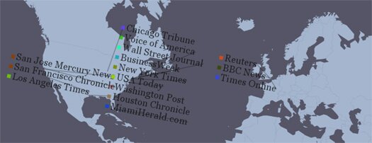
Create Vector Maps With HTML5 & Canvas – Cartegan
Cartegan is an open source HTML5 & Canvas based framework for creating and rendering vector maps, ideal for news channles, reporting agencies & GPS type navigation service providers.

Cartagen draws maps dynamically on the client side and maps can:
- move
- adapt
- redraw
- and can include as many layers of data as needed
Vector mapping is done in native HTML 5 & styled wth GSS (cascading stylesheet specification for geospatial information). Maps created with this open source software use less bandwidth and can run easily on the iPhone and the Android platforms.
3 Responses
[...] Create Vector Maps With HTML5 & Canvas | Cartegan – Create and render vector maps in native HTML5 and GSS. [...]
[...] Create Vector Maps With HTML5 & Canvas | Cartegan – Create and render vector maps in native HTML5 and GSS. [...]
[...] HTML5 Maps: Cartagen Maps are a huge part of interactive graphics and data visualization. The days of hover over Flash maps are dying. Might as well stop the coffin dodging and do it up properly with Cartagen. But, there is always the native maps functionality in the HTML5 API so you should explore that as well. Here is another example. [...]